


création Marc

Maca8284
User

Length
6.1 km

Max alt
906 m

Uphill gradient
151 m
Km-Effort
8.1 km

Min alt
780 m

Downhill gradient
149 m
Boucle
Yes
Creation date :
2022-08-24 13:07:39.791
Updated on :
2022-08-24 13:07:42.785
1h50
Difficulty : Medium

FREE GPS app for hiking
 SityTrail
IGN / Geographical institutes
SityTrail Plus
The world is yours!
About
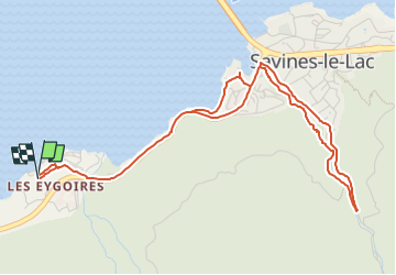
Trail Walking of 6.1 km to be discovered at Provence-Alpes-Côte d'Azur, Hautes-Alpes, Savines-le-Lac. This trail is proposed by Maca8284.
Positioning
Country:
France
Region :
Provence-Alpes-Côte d'Azur
Department/Province :
Hautes-Alpes
Municipality :
Savines-le-Lac
Location:
Unknown
Start:(Dec)
Start:(UTM)
292066 ; 4932890 (32T) N.
Comments