


Cirque de Troumouse depuis Heas

katiab
User
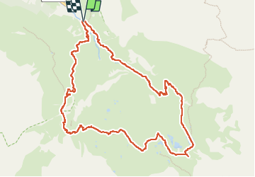

Length
12.4 km

Max alt
2130 m

Uphill gradient
653 m
Km-Effort
21 km

Min alt
1532 m

Downhill gradient
658 m
Boucle
Yes
Creation date :
2022-08-23 07:40:49.198
Updated on :
2022-08-30 13:29:53.966
4h44
Difficulty : Medium

FREE GPS app for hiking
 SityTrail
IGN / Geographical institutes
SityTrail Plus
The world is yours!
About
Trail Walking of 12.4 km to be discovered at Occitania, Hautespyrenees, Gavarnie-Gèdre. This trail is proposed by katiab.
Description
Belle montée jusqu’a la cabane des Aires et traversée du cirque en boucle. Après l’auberge des Maillets, le sentier de descente n’est guère marqué ni entretenu (quelques passages ravinés).
Positioning
Country:
France
Region :
Occitania
Department/Province :
Hautespyrenees
Municipality :
Gavarnie-Gèdre
Location:
Gèdre
Start:(Dec)
Start:(UTM)
261849 ; 4737016 (31T) N.
Comments