


SISTERON Mézien , St Jacques de Compostel n

RobinMicheline
User GUIDE

Length
11.7 km

Max alt
820 m

Uphill gradient
459 m
Km-Effort
17.8 km

Min alt
477 m

Downhill gradient
462 m
Boucle
Yes
Creation date :
2022-08-27 05:03:06.608
Updated on :
2022-08-27 14:48:09.517
3h16
Difficulty : Medium

FREE GPS app for hiking
 SityTrail
IGN / Geographical institutes
SityTrail Plus
The world is yours!
About
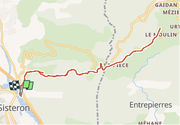
Trail Walking of 11.7 km to be discovered at Provence-Alpes-Côte d'Azur, Alpes-de-Haute-Provence, Sisteron. This trail is proposed by RobinMicheline.
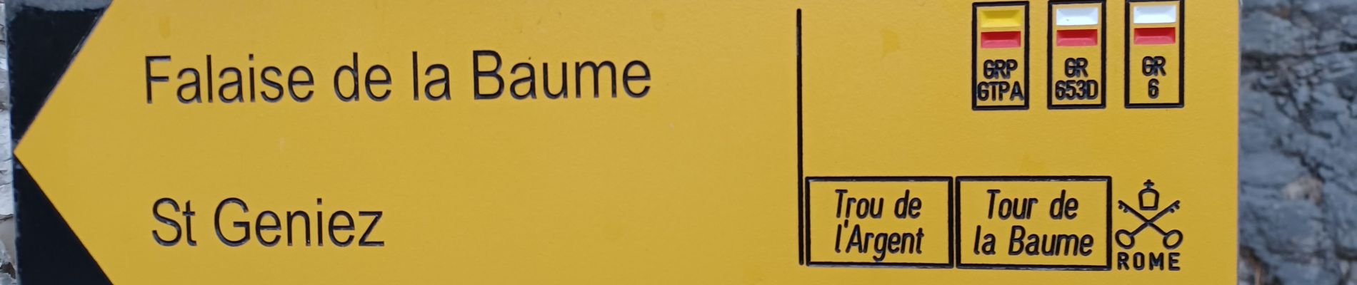
Photos


Positioning
Country:
France
Region :
Provence-Alpes-Côte d'Azur
Department/Province :
Alpes-de-Haute-Provence
Municipality :
Sisteron
Location:
Unknown
Start:(Dec)
Start:(UTM)
735488 ; 4898222 (31T) N.
Comments