


 - Photo 21")
 - Photo 22")
 - Photo 23")
 - Photo 24")
 - Photo 25")
 - Photo 26")
 - Photo 27")
 - Photo 28")
 - Photo 29")
 - Photo 30")
 - Photo 31")
 - Photo 32")
 - Photo 33")
 - Photo 34")
 - Photo 35")
 - Photo 36")
 - Photo 37")
 - Photo 38")
 - Photo 39")
 - Photo 40")
 - Photo 41")
 - Photo 42")
 - Photo 43")
 - Photo 44")
 - Photo 45")
 - Photo 46")
 - Photo 47")
 - Photo 48")
 - Photo 49")
 - Photo 50")
 - Photo 51")
 - Photo 52")
 - Photo 53")
 - Photo 54")
 - Photo 55")
 - Photo 56")
 - Photo 57")
 - Photo 58")
 - Photo 59")
 - Photo 60")
 - Photo 61")
 - Photo 62")
 - Photo 63")
 - Photo 64")
 - Photo 65")
 - Photo 66")
 - Photo 67")
 - Photo 68")
 - Photo 69")
 - Photo 70")
 - Photo 71")
 - Photo 72")
 - Photo 73")
 - Photo 74")
 - Photo 75")
 - Photo 76")
 - Photo 77")
 - Photo 78")
 - Photo 79")
 - Photo 80")
 - Photo 81")
 - Photo 82")
 - Photo 83")
 - Photo 84")
 - Photo 85")

8 km | 13.4 km-effort

User


FREE GPS app for hiking
 SityTrail
IGN / Geographical institutes
SityTrail World
The world is yours!
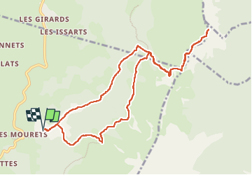
Trail Walking of 11.9 km to be discovered at Auvergne-Rhône-Alpes, Isère, Villard-de-Lans. This trail is proposed by Philindy26.
Départ du hameau "La Conversaria" (1180 m), à Villard-de-Lans (Isère)...
Géolocalisation (Google Maps) : https://goo.gl/maps/2JRPWvkeSPRe73DB8
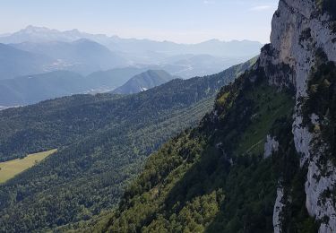
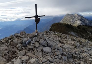
Monter par la piste des Prairies de Machiret (1330 m) en passant par La Ya (1215 m). Puis direction Font Froide (1500 m), le Col de l'Arc (1736 m) et le Pic Saint-Michel (1966 m).
Descendre par le même chemin jusqu'à Font Froide (1500 m).
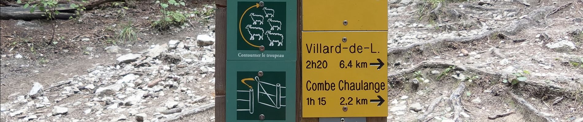
Là prendre à gauche le GR 91 (GR de Pays, Tour des Quatre Montagnes) jusqu'à la Combe Chaulange (1530 m).
Dernière descente sur La Ya (1215 m) et retour au parking de la Conversaria.
 - Photo 1")
 - Photo 2")
 - Photo 3")
 - Photo 4")
 - Photo 5")
 - Photo 6")
 - Photo 7")
 - Photo 8")
 - Photo 9")
 - Photo 10")
 - Photo 11")
 - Photo 12")
 - Photo 13")
 - Photo 14")
 - Photo 15")
 - Photo 16")
 - Photo 17")
 - Photo 18")
 - Photo 19")
 - Photo 20")
85 photos in total. Please click on a photo to see them all in the gallery.

Snowshoes

Walking

Walking
Walking
Walking
Walking

Snowshoes

Mountain bike

Walking
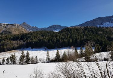
Un super parcours que je n'ai pas pu faire jusqu'au bout au vu des conditions météorologiques. Je me suis arrêtée au niveau du Col de l'Arc. Merci pour la découverte de cette boucle, c'était très beau en hiver.