


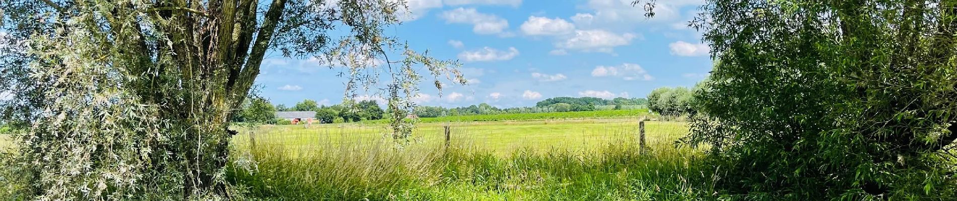
La vallée de l’Oude Kale à Merendree

Benjamin27
User GUIDE


1h39
Difficulty : Medium

FREE GPS app for hiking
 SityTrail
IGN / Geographical institutes
SityTrail Plus
The world is yours!
About
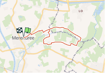
Trail Walking of 6.9 km to be discovered at Flanders, East Flanders, Deinze. This trail is proposed by Benjamin27.
Description
La vallée de l’Oude Kale est une des réserves naturelles les mieux préservées du Meetjesland. Le cours d’eau serpente le paysage magnifique au milieu de prairies fleuries, d’arbres exceptionnels et de forêts marécageuses.
👣 Distance : 7km - balisage hexagone avec « Oude Kalevallei wandelroute » écrit en vert.
📍Départ : parking de l’église, merendreedorp 31 - 9850 Merendree.
🚂🚍 Aller à la gare de Landegem et marcher 25 minutes jusqu’au point de départ de la promenade.
Photos

Positioning
Comments