Trail Walking Manigod - ARAVIS: POINTE D'ORSIERE VARIANTE - Photo

ARAVIS: POINTE D'ORSIERE VARIANTE

© OpenStreetMap contributors
Length
Length
11 km
Max alt
Max alt
1739 m
Uphill gradient
Uphill gradient
783 m
Km-Effort
Km-Effort  
21 km
Min alt
Min alt
959 m
Downhill gradient
Downhill gradient
783 m
Boucle
Boucle
Yes
Creation date :
2022-08-28 06:44:43.164
Updated on :
2022-08-29 09:52:35.539

(0 Reviews)

Walking
Walking
4h09
Difficulty : Medium

Scan this QR Code to open this trail in the SityTrail application

FREE GPS app for hiking

Logo SityTrail SityTrail

IGN / Geographical institutes

Download SityTrail from the App Store Download SityTrail from Google Play

Logo SityTrail SityTrail World

The world is yours!

Download SityTrail from the App Store Download SityTrail from Google Play Download SityTrail on Huawei AppGallery

About

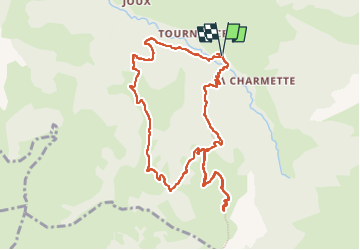
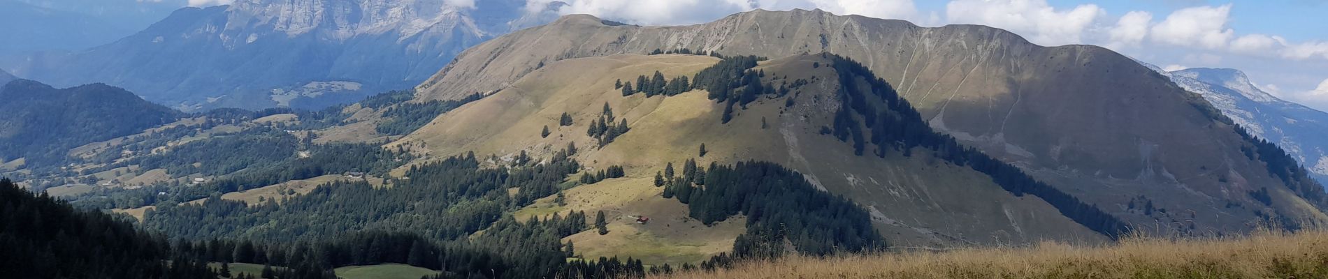
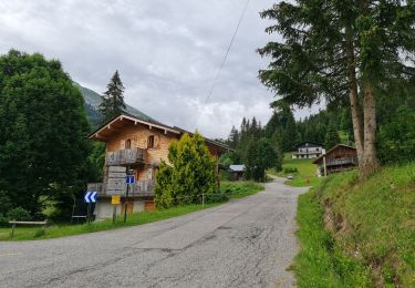
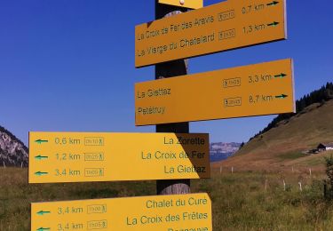
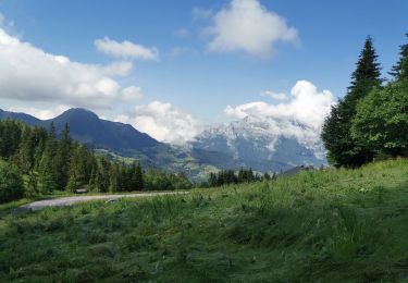
Trail Walking of 11 km to be discovered at Auvergne-Rhône-Alpes, Upper Savoy, Manigod. This trail is proposed by djeepee74.

Description

BOUCLE... live le 20220829
Montée par la "piste"... descente "épique" par La Balme (mieux vaut éviter d'y descendre par terrain humide ! Inverser alors le sens, voir: https://www.sitytrail.com/fr/trails/3344572-manigod--aravisx-pointe-dxorsiere/ )

Elevation profile

Photos

Positioning

Country:
France
Region :
Auvergne-Rhône-Alpes
Department/Province :
Upper Savoy
Municipality :
Manigod
Location:
Unknown
Start:(UTM)
298551 ; 5080276 (32T) N.

Trails nearby

Trail Snowshoes Manigod - croix de colonban croix de fry - Photo
Snowshoes
myjackotte

Snowshoes

Medium
(3)
Manigod, Auvergne-Rhône-Alpes, Upper Savoy, France
8 km | 11.6 km-effort
3h 5min
Yes
Trail Walking La Clusaz - Les Converses, Le Planet, Beauregard, les Corbassières (boucle) - Photo
Walking
GUIDE
lhomme.ph

Walking

Difficult
La Clusaz, Auvergne-Rhône-Alpes, Upper Savoy, France
10.4 km | 17.7 km-effort
3h 11min
Yes
Trail Snowshoes La Clusaz - col aravis - Photo
Snowshoes
myjackotte

Snowshoes

Easy
(2)
La Clusaz, Auvergne-Rhône-Alpes, Upper Savoy, France
5.7 km | 8.2 km-effort
2h 16min
Yes
Trail Walking Le Bouchet-Mont-Charvin - Lac Charvin - Photo
Walking
castellas83

Walking

Difficult
(1)
Le Bouchet-Mont-Charvin, Auvergne-Rhône-Alpes, Upper Savoy, France
3.7 km | 10.7 km-effort
2h 15min
No
Trail Mountain bike La Clusaz - VTT Aravis  - Photo
Mountain bike
Tibo74lc

Mountain bike

Medium
(1)
La Clusaz, Auvergne-Rhône-Alpes, Upper Savoy, France
35 km | 52 km-effort
2h 38min
Yes
Trail Mountain bike La Clusaz - Aravis  - Photo
Mountain bike
Tibo74lc

Mountain bike

Very easy
(1)
La Clusaz, Auvergne-Rhône-Alpes, Upper Savoy, France
43 km | 63 km-effort
3h 46min
Yes
Trail Motor La Giettaz - La Giettaz - Col des Aravis - Photo
Motor
albertville

Motor

Very easy
(1)
La Giettaz, Auvergne-Rhône-Alpes, Savoy, France
15.8 km | 23 km-effort
58min
No
Trail Walking La Clusaz - Col des ARAVIS ... la Croix des Frêtes. - Photo
Walking
GerardBouche

Walking

Difficult
La Clusaz, Auvergne-Rhône-Alpes, Upper Savoy, France
7.4 km | 12.1 km-effort
2h 14min
Yes
Trail Walking Manigod - La Clusaz ... au départ du col de la Croix de FRY. - Photo
Walking
GerardBouche

Walking

Easy
Manigod, Auvergne-Rhône-Alpes, Upper Savoy, France
7.6 km | 10.4 km-effort
2h 6min
Yes


Close
My subscriptions