


Devoluy Grotte de la Fetoure

c.gourme
User
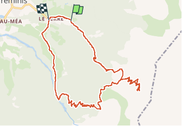

Length
14.2 km

Max alt
2142 m

Uphill gradient
1162 m
Km-Effort
30 km

Min alt
968 m

Downhill gradient
1235 m
Boucle
No
Creation date :
2022-08-29 05:25:19.0
Updated on :
2022-08-29 12:51:54.845
6h20
Difficulty : Difficult

FREE GPS app for hiking
 SityTrail
IGN / Geographical institutes
SityTrail Plus
The world is yours!
About
Trail Walking of 14.2 km to be discovered at Auvergne-Rhône-Alpes, Isère, Tréminis. This trail is proposed by c.gourme.
Positioning
Country:
France
Region :
Auvergne-Rhône-Alpes
Department/Province :
Isère
Municipality :
Tréminis
Location:
Unknown
Start:(Dec)
Start:(UTM)
720742 ; 4958024 (31T) N.
Comments