


Mourre de Simance

Clo0413
User
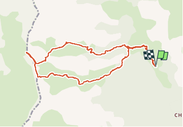

Length
11.3 km

Max alt
2485 m

Uphill gradient
953 m
Km-Effort
24 km

Min alt
1528 m

Downhill gradient
953 m
Boucle
Yes
Creation date :
2022-08-29 06:40:43.174
Updated on :
2022-08-29 19:14:43.745
4h20
Difficulty : Medium

FREE GPS app for hiking
 SityTrail
IGN / Geographical institutes
SityTrail Plus
The world is yours!
About
Trail Walking of 11.3 km to be discovered at Provence-Alpes-Côte d'Azur, Alpes-de-Haute-Provence, Villars-Colmars. This trail is proposed by Clo0413.
Positioning
Country:
France
Region :
Provence-Alpes-Côte d'Azur
Department/Province :
Alpes-de-Haute-Provence
Municipality :
Villars-Colmars
Location:
Unknown
Start:(Dec)
Start:(UTM)
306330 ; 4896675 (32T) N.
Comments