


crêtes Embrunais Ubaye

orsel
User GUIDE

Length
17.5 km

Max alt
2498 m

Uphill gradient
1184 m
Km-Effort
33 km

Min alt
1625 m

Downhill gradient
1201 m
Boucle
Yes
Creation date :
2022-08-29 05:39:27.218
Updated on :
2022-08-29 16:11:46.849
10h29
Difficulty : Difficult

FREE GPS app for hiking
 SityTrail
IGN / Geographical institutes
SityTrail Plus
The world is yours!
About
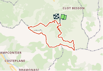
Trail Walking of 17.5 km to be discovered at Provence-Alpes-Côte d'Azur, Hautes-Alpes, Crots. This trail is proposed by orsel.
Description
petit passage délicat entre joug de l'aigle et cime du col haut
Positioning
Country:
France
Region :
Provence-Alpes-Côte d'Azur
Department/Province :
Hautes-Alpes
Municipality :
Crots
Location:
Unknown
Start:(Dec)
Start:(UTM)
299620 ; 4927388 (32T) N.
Comments