


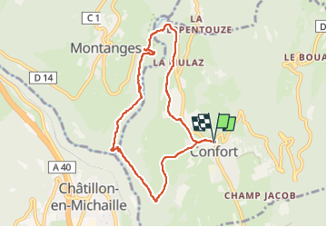
Confort pont des pierres

HB01
User

Length
8.1 km

Max alt
554 m

Uphill gradient
249 m
Km-Effort
11.4 km

Min alt
387 m

Downhill gradient
249 m
Boucle
Yes
Creation date :
2022-09-01 11:49:48.507
Updated on :
2022-09-01 14:18:36.728
2h04
Difficulty : Easy

FREE GPS app for hiking
 SityTrail
IGN / Geographical institutes
SityTrail Plus
The world is yours!
About
Trail Walking of 8.1 km to be discovered at Auvergne-Rhône-Alpes, Ain, Confort. This trail is proposed by HB01.
Description
Départ de confort ou du pont des pierres
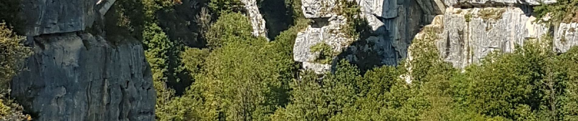
Photos

Positioning
Country:
France
Region :
Auvergne-Rhône-Alpes
Department/Province :
Ain
Municipality :
Confort
Location:
Unknown
Start:(Dec)
Start:(UTM)
717937 ; 5114690 (31T) N.
Comments