


un tour de Saou

andrechauvin
User
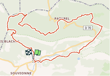

Length
15.2 km

Max alt
874 m

Uphill gradient
648 m
Km-Effort
24 km

Min alt
326 m

Downhill gradient
649 m
Boucle
Yes
Creation date :
2022-09-01 07:20:03.703
Updated on :
2022-09-01 16:36:11.58
6h02
Difficulty : Medium

FREE GPS app for hiking
 SityTrail
IGN / Geographical institutes
SityTrail Plus
The world is yours!
About
Trail Walking of 15.2 km to be discovered at Auvergne-Rhône-Alpes, Drôme, Saou. This trail is proposed by andrechauvin.
Description
rando decouverte
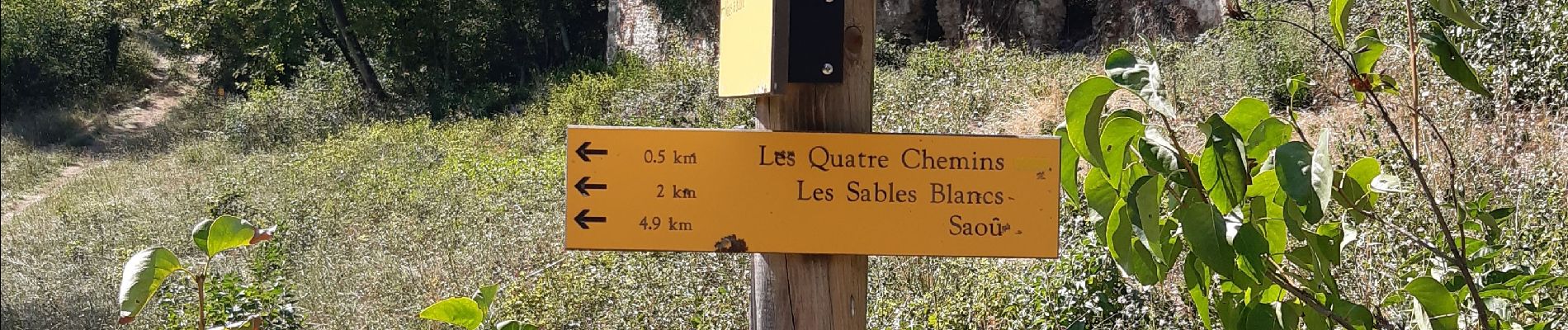
Photos


Positioning
Country:
France
Region :
Auvergne-Rhône-Alpes
Department/Province :
Drôme
Municipality :
Saou
Location:
Unknown
Start:(Dec)
Start:(UTM)
663402 ; 4945745 (31T) N.
Comments