


Gavarnie (la Cascade)

chasle
User
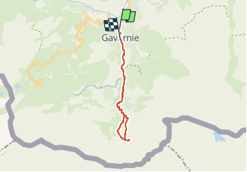

Length
11.8 km

Max alt
1957 m

Uphill gradient
601 m
Km-Effort
19.8 km

Min alt
1371 m

Downhill gradient
599 m
Boucle
No
Creation date :
2022-08-28 06:53:54.305
Updated on :
2022-09-02 08:35:00.785
3h14
Difficulty : Medium

FREE GPS app for hiking
 SityTrail
IGN / Geographical institutes
SityTrail Plus
The world is yours!
About
Trail Walking of 11.8 km to be discovered at Occitania, Hautespyrenees, Gavarnie-Gèdre. This trail is proposed by chasle.
Positioning
Country:
France
Region :
Occitania
Department/Province :
Hautespyrenees
Municipality :
Gavarnie-Gèdre
Location:
Gavarnie
Start:(Dec)
Start:(UTM)
744756 ; 4735689 (30T) N.
Comments