


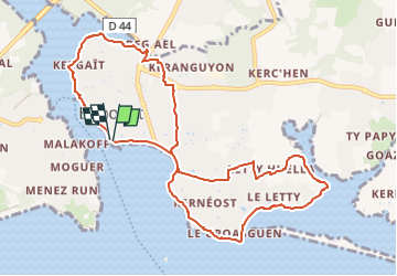
BENODET RRD VF 10 km

Dolou
User

Length
10.4 km

Max alt
24 m

Uphill gradient
93 m
Km-Effort
11.6 km

Min alt
-1 m

Downhill gradient
92 m
Boucle
Yes
Creation date :
2022-09-04 08:38:16.313
Updated on :
2022-09-04 08:38:50.866
2h38
Difficulty : Easy

FREE GPS app for hiking
 SityTrail
IGN / Geographical institutes
SityTrail Plus
The world is yours!
About
Trail On foot of 10.4 km to be discovered at Brittany, Finistère, Bénodet. This trail is proposed by Dolou.
Positioning
Country:
France
Region :
Brittany
Department/Province :
Finistère
Municipality :
Bénodet
Location:
Unknown
Start:(Dec)
Start:(UTM)
416949 ; 5302636 (30T) N.
Comments