


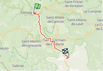
étape 13 Cassagnas /Pont de Burgen

PatriceCocuaud
User

Length
19.5 km

Max alt
1034 m

Uphill gradient
395 m
Km-Effort
27 km

Min alt
271 m

Downhill gradient
988 m
Boucle
No
Creation date :
2022-09-04 07:15:56.409
Updated on :
2022-09-04 13:12:09.491
5h01
Difficulty : Medium

FREE GPS app for hiking
 SityTrail
IGN / Geographical institutes
SityTrail Plus
The world is yours!
About
Trail Walking of 19.5 km to be discovered at Occitania, Lozère, Cassagnas. This trail is proposed by PatriceCocuaud.
Positioning
Country:
France
Region :
Occitania
Department/Province :
Lozère
Municipality :
Cassagnas
Location:
Unknown
Start:(Dec)
Start:(UTM)
560496 ; 4902212 (31T) N.
Comments