Trail Walking Sault-Brénaz - 01-Sault-Brenaz-18.5km-740m-sept22 - Photo

01-Sault-Brenaz-18.5km-740m-sept22

 SyMA
SyMA

User

© OpenStreetMap contributors
Length
Length
18.5 km
Max alt
Max alt
702 m
Uphill gradient
Uphill gradient
741 m
Km-Effort
Km-Effort  
28 km
Min alt
Min alt
200 m
Downhill gradient
Downhill gradient
742 m
Boucle
Boucle
Yes
Creation date :
2022-09-08 07:06:02.617
Updated on :
2022-09-11 10:39:45.979

(0 Reviews)

Walking
Walking
5h57
Difficulty : Medium

Scan this QR Code to open this trail in the SityTrail application

FREE GPS app for hiking

Logo SityTrail SityTrail

IGN / Geographical institutes

Download SityTrail from the App Store Download SityTrail from Google Play

Logo SityTrail SityTrail World

The world is yours!

Download SityTrail from the App Store Download SityTrail from Google Play Download SityTrail on Huawei AppGallery

About

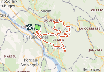
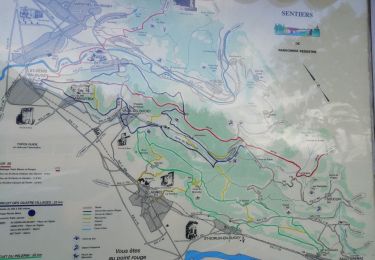
Trail Walking of 18.5 km to be discovered at Auvergne-Rhône-Alpes, Ain, Sault-Brénaz. This trail is proposed by SyMA.

Description

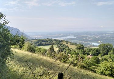
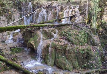
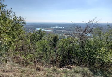
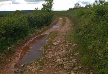
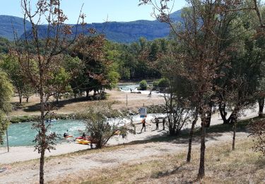
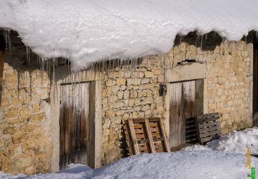
Très belle rando (points de vue sur Rhône/ beaux villages / conciliabulum../ tufiere/ cascade/demoiselles de Villebois)
Départ monument aux mortsprés du Rhône.

Elevation profile

Photos

Positioning

Country:
France
Region :
Auvergne-Rhône-Alpes
Department/Province :
Ain
Municipality :
Sault-Brénaz
Location:
Unknown
Start:(UTM)
686720 ; 5081036 (31T) N.

Trails nearby

Trail Walking Saint-Sorlin-en-Bugey - 20140331 Tour de Saint Sorlin - Photo
Walking
moussfly

Walking

Easy
(1)
Saint-Sorlin-en-Bugey, Auvergne-Rhône-Alpes, Ain, France
7.7 km | 8.5 km-effort
1h 41min
Yes
Trail Walking Souclin - 01-soudon-cleyzieu-20km825m - Photo
Walking
SyMA

Walking

Difficult
Souclin, Auvergne-Rhône-Alpes, Ain, France
20 km | 31 km-effort
7h 2min
Yes
Trail Walking Sault-Brénaz - 18 novembre 2022 Sault Brenat - Photo
Walking
Parodie69

Walking

Medium
Sault-Brénaz, Auvergne-Rhône-Alpes, Ain, France
20 km | 31 km-effort
8h 8min
Yes
Trail Walking Villebois - les balcons de souclin hameau de buis - Photo
Walking
colomb24

Walking

Medium
(1)
Villebois, Auvergne-Rhône-Alpes, Ain, France
16.1 km | 24 km-effort
5h 3min
Yes
Trail Walking Saint-Sorlin-en-Bugey - 01-St-Sorlin-Bugey-17km-680m-aout21 - Photo
Walking
SyMA

Walking

Medium
Saint-Sorlin-en-Bugey, Auvergne-Rhône-Alpes, Ain, France
16.6 km | 26 km-effort
4h 5min
Yes
Trail Mountain bike Parmilieu - Parmilieu 10 2014 - Photo
Mountain bike
adupuped

Mountain bike

Medium
(1)
Parmilieu, Auvergne-Rhône-Alpes, Isère, France
16.3 km | 21 km-effort
1h 49min
Yes
Trail Walking Souclin - 01 st sorlin en bugey - Photo
Walking
himba26100

Walking

Easy
Souclin, Auvergne-Rhône-Alpes, Ain, France
9.5 km | 14.2 km-effort
2h 41min
No
Trail Electric bike Montalieu-Vercieu - Le Tour de la Vallée Bleue en VAE - Photo
Electric bike
Baroux

Electric bike

Medium
Montalieu-Vercieu, Auvergne-Rhône-Alpes, Isère, France
24 km | 26 km-effort
Unknown
Yes
Trail Snowshoes Villebois - Le Crêt de Pont 1059m, depuis Bouis - Photo
Snowshoes
tracegps

Snowshoes

Easy
Villebois, Auvergne-Rhône-Alpes, Ain, France
14.1 km | 24 km-effort
5h 30min
Yes


Close
My subscriptions