


TOULON / BORMES LES MIMOSAS: LA LONDE

djeepee74
User
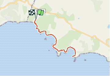

Length
8.8 km

Max alt
28 m

Uphill gradient
94 m
Km-Effort
10 km

Min alt
0 m

Downhill gradient
95 m
Boucle
Yes
Creation date :
2022-09-10 10:36:02.194
Updated on :
2022-09-15 14:54:34.069
3h04
Difficulty : Easy

FREE GPS app for hiking
 SityTrail
IGN / Geographical institutes
SityTrail Plus
The world is yours!
About
Trail Walking of 8.8 km to be discovered at Provence-Alpes-Côte d'Azur, Var, Bormes-les-Mimosas. This trail is proposed by djeepee74.
Description
ALLER / RETOUR... live du 20220910
Photos


Positioning
Country:
France
Region :
Provence-Alpes-Côte d'Azur
Department/Province :
Var
Municipality :
Bormes-les-Mimosas
Location:
Unknown
Start:(Dec)
Start:(UTM)
278526 ; 4777989 (32T) N.
Comments