


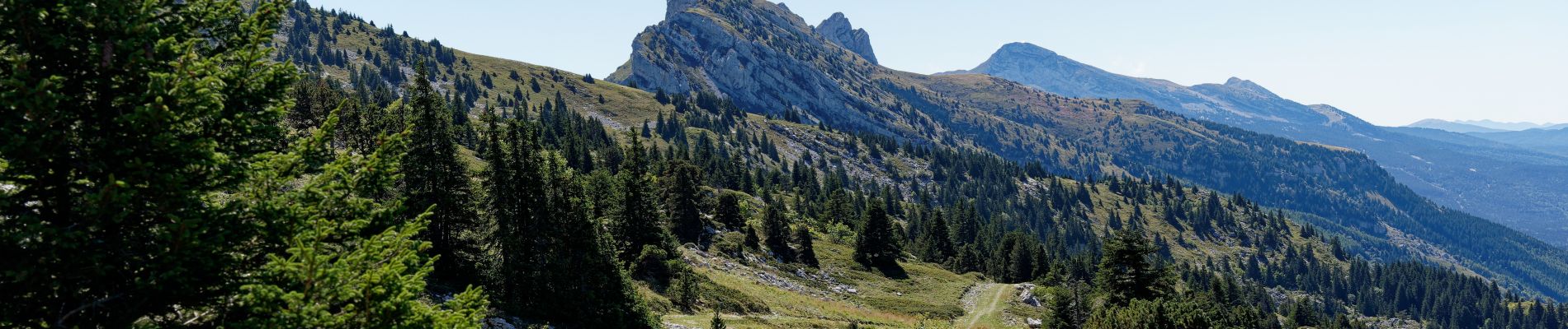
Rando vertige des cimes Septembre 2022

pconte
User
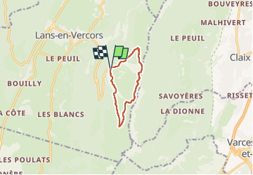

Length
8.1 km

Max alt
1797 m

Uphill gradient
445 m
Km-Effort
14.1 km

Min alt
1389 m

Downhill gradient
443 m
Boucle
Yes
Creation date :
2022-09-11 08:27:00.0
Updated on :
2022-09-12 08:39:39.855
3h47
Difficulty : Difficult

FREE GPS app for hiking
 SityTrail
IGN / Geographical institutes
SityTrail Plus
The world is yours!
About
Trail Walking of 8.1 km to be discovered at Auvergne-Rhône-Alpes, Isère, Lans-en-Vercors. This trail is proposed by pconte.
Photos


Positioning
Country:
France
Region :
Auvergne-Rhône-Alpes
Department/Province :
Isère
Municipality :
Lans-en-Vercors
Location:
Unknown
Start:(Dec)
Start:(UTM)
705282 ; 4999197 (31T) N.
Comments