Trail Walking Lussan - LUSSAN (30)   Baume des Boeufs - Photo

LUSSAN (30) Baume des Boeufs

 Manoune
Manoune

User

© OpenStreetMap contributors
Length
Length
16.7 km
Max alt
Max alt
306 m
Uphill gradient
Uphill gradient
321 m
Km-Effort
Km-Effort  
21 km
Min alt
Min alt
148 m
Downhill gradient
Downhill gradient
334 m
Boucle
Boucle
Yes
Creation date :
2022-09-11 07:23:40.706
Updated on :
2022-09-12 14:00:07.811

(0 Reviews)

Walking
Walking
5h39
Difficulty : Medium

Scan this QR Code to open this trail in the SityTrail application

FREE GPS app for hiking

Logo SityTrail SityTrail

IGN / Geographical institutes

Download SityTrail from the App Store Download SityTrail from Google Play

Logo SityTrail SityTrail World

The world is yours!

Download SityTrail from the App Store Download SityTrail from Google Play Download SityTrail on Huawei AppGallery

About

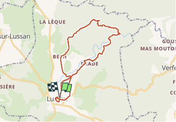
Trail Walking of 16.7 km to be discovered at Occitania, Gard, Lussan. This trail is proposed by Manoune.

Description

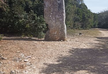
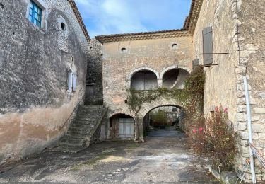
Départ du parking des visiteurs sou le Château, prendre direction cimetière, Balisage jaune, contourner la Tuilerie, traverser l'Aiguillon, Beth, Plan de Bourguet, la Pierre Plantée, à droite vers la combe de Queue de Boeuf, faire attention à la descente, passage avec cable, le Portail, suivre toujours le jaune, jolis points de vues sur votre droite avec des grottes au dessus de l'Aiguillon, à droite sur le plateau vers Lussan, le Moulin, à gauche sur la D787, sur environ 100 m puis à droite , le Vallen, Le Mas Chazet et retour au Parking; ( faire lev tour du village de Lussan avant ou au retour) Bonne rando.
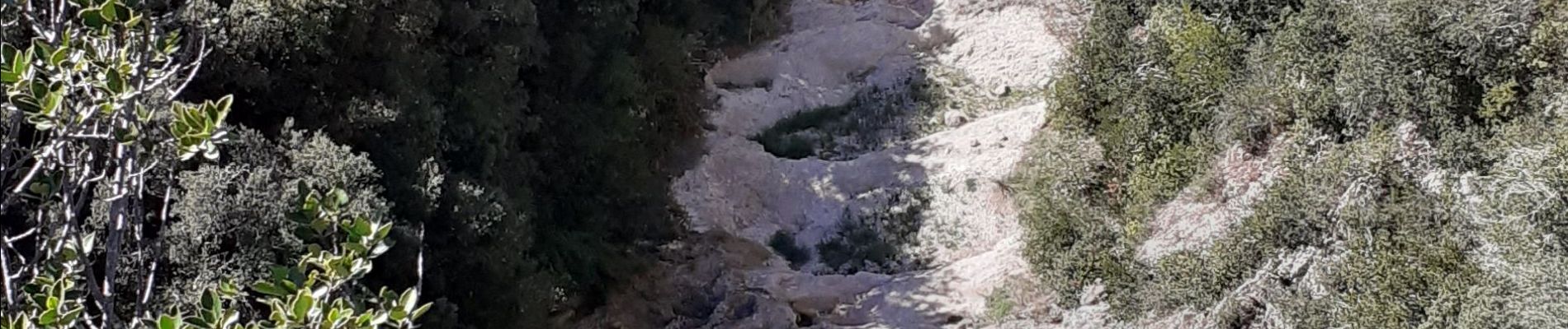
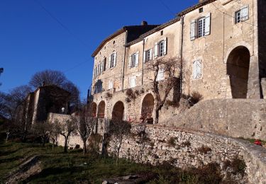
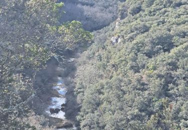
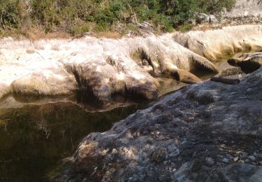
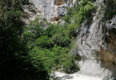
Elevation profile

Photos

Positioning

Country:
France
Region :
Occitania
Department/Province :
Gard
Municipality :
Lussan
Location:
Unknown
Start:(UTM)
609341 ; 4889849 (31T) N.

Trails nearby

Trail Walking Lussan - Concluses de Lussan - Photo
Walking
GUIDE
nadinebondoux

Walking

Difficult
Lussan, Occitania, Gard, France
26 km | 0 m-effort
5h 46min
No
Trail Walking Lussan - 30 les concluses - Photo
Walking
himba26100

Walking

Easy
(1)
Lussan, Occitania, Gard, France
8 km | 11.1 km-effort
2h 24min
No
Trail Walking Lussan - LUSSAN - LES CONCLUSES - 11.3 Km - 3h30 - Dénivelé 170 m  - Photo
Walking
dansmabulle

Walking

Difficult
(2)
Lussan, Occitania, Gard, France
11.3 km | 15 km-effort
3h 21min
Yes
Trail Walking Lussan - de Prades au Concluses - Photo
Walking
GUIDE
nadinebondoux

Walking

Medium
Lussan, Occitania, Gard, France
9.6 km | 12.9 km-effort
2h 48min
Yes
Trail Walking Lussan - randonnée Prades les concluses  - Photo
Walking
bidetarou

Walking

Medium
Lussan, Occitania, Gard, France
11 km | 15.6 km-effort
3h 50min
Yes
Trail Walking Fons-sur-Lussan - Serre de Fons - Photo
Walking
xmayeur

Walking

Medium
Fons-sur-Lussan, Occitania, Gard, France
4.7 km | 6.7 km-effort
1h 39min
No
Trail Walking Lussan - 30 conclused - Photo
Walking
himba26100

Walking

Difficult
Lussan, Occitania, Gard, France
14.3 km | 19.6 km-effort
7h 57min
Yes
Trail Walking Lussan - 30-Lussan-concluses-4.5km-170m-juin21 - Photo
Walking
SyMA

Walking

Easy
Lussan, Occitania, Gard, France
4.5 km | 6.7 km-effort
1h 26min
Yes
Trail Walking Lussan - mas chazel audabiac et retour - Photo
Walking
nanard223

Walking

Medium
(1)
Lussan, Occitania, Gard, France
9 km | 10.4 km-effort
2h 17min
Yes


Close
My subscriptions