


Estaing G3 2022

LouisROGER
User GUIDE
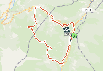

Length
10.4 km

Max alt
1519 m

Uphill gradient
579 m
Km-Effort
18.2 km

Min alt
971 m

Downhill gradient
584 m
Boucle
No
Creation date :
2022-09-09 07:34:56.253
Updated on :
2022-09-12 12:47:01.792
5h39
Difficulty : Difficult

FREE GPS app for hiking
 SityTrail
IGN / Geographical institutes
SityTrail Plus
The world is yours!
About
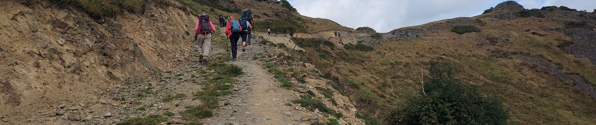
Trail Walking of 10.4 km to be discovered at Occitania, Hautespyrenees, Estaing. This trail is proposed by LouisROGER.
Photos

Positioning
Country:
France
Region :
Occitania
Department/Province :
Hautespyrenees
Municipality :
Estaing
Location:
Unknown
Start:(Dec)
Start:(UTM)
730222 ; 4757680 (30T) N.
Comments