


TMB8 CAF 24

reneperrin
User
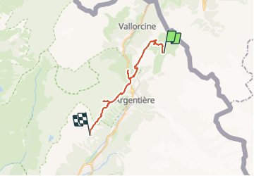

Length
17.5 km

Max alt
2203 m

Uphill gradient
1176 m
Km-Effort
33 km

Min alt
1416 m

Downhill gradient
1220 m
Boucle
No
Creation date :
2022-09-10 06:04:05.083
Updated on :
2024-01-08 08:37:58.817
7h33
Difficulty : Very difficult

FREE GPS app for hiking
 SityTrail
IGN / Geographical institutes
SityTrail Plus
The world is yours!
About
Trail Walking of 17.5 km to be discovered at Auvergne-Rhône-Alpes, Upper Savoy, Chamonix-Mont-Blanc. This trail is proposed by reneperrin.
Description
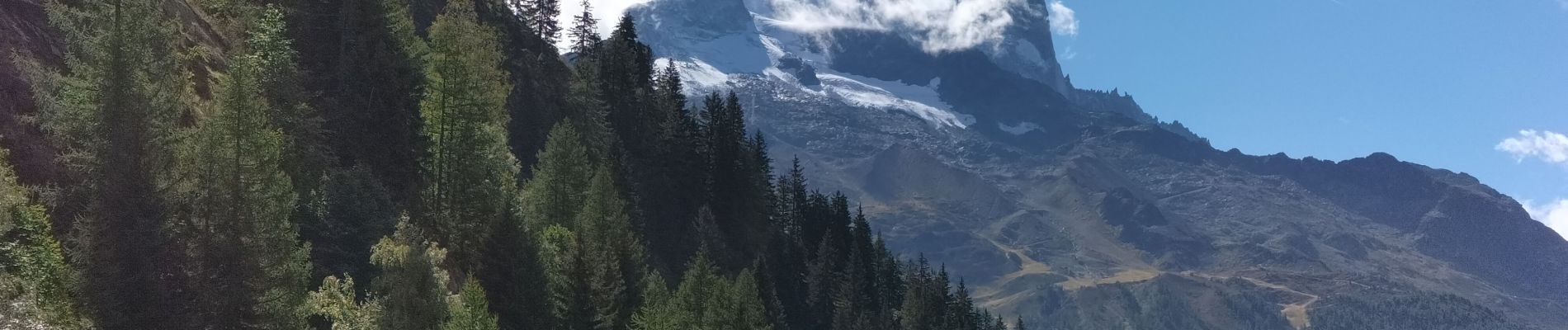
Charamillon Flégère par Posettes et Montets
Photos


Positioning
Country:
France
Region :
Auvergne-Rhône-Alpes
Department/Province :
Upper Savoy
Municipality :
Chamonix-Mont-Blanc
Location:
Unknown
Start:(Dec)
Start:(UTM)
341984 ; 5097821 (32T) N.
Comments