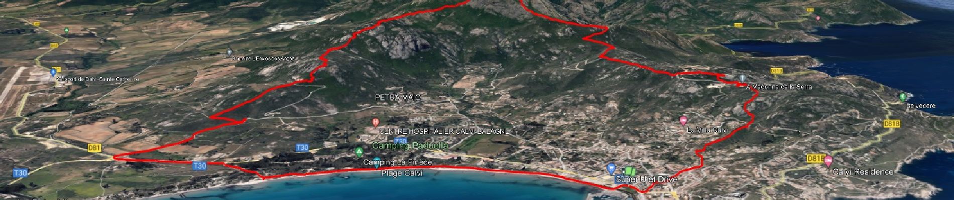
Calvi - Capu di a Veta - Croix des autrichiens

affinetataille
User GUIDE
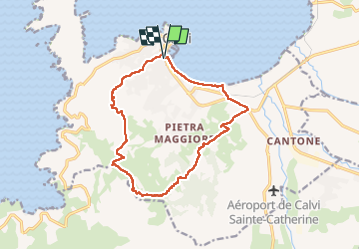

Length
15.6 km

Max alt
693 m

Uphill gradient
752 m
Km-Effort
26 km

Min alt
0 m

Downhill gradient
755 m
Boucle
Yes
Creation date :
2022-09-14 04:31:23.402
Updated on :
2022-09-18 17:10:03.351
5h30
Difficulty : Difficult

FREE GPS app for hiking
 SityTrail
IGN / Geographical institutes
SityTrail Plus
The world is yours!
About
Trail Walking of 15.6 km to be discovered at Corsica, Haute-Corse, Calvi. This trail is proposed by affinetataille.
Photos


22 photos in total. Please click on a photo to see them all in the gallery.
Positioning
Country:
France
Region :
Corsica
Department/Province :
Haute-Corse
Municipality :
Calvi
Location:
Unknown
Start:(Dec)
Start:(UTM)
479872 ; 4712267 (32T) N.
Comments