


Valfererra-Pinet

ARVIEU
User
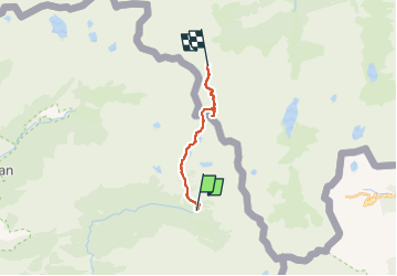

Length
11.7 km

Max alt
3095 m

Uphill gradient
1274 m
Km-Effort
28 km

Min alt
1926 m

Downhill gradient
972 m
Boucle
No
Creation date :
2022-09-14 11:34:55.672
Updated on :
2022-09-14 11:36:46.096
9h00
Difficulty : Very difficult

FREE GPS app for hiking
 SityTrail
IGN / Geographical institutes
SityTrail Plus
The world is yours!
About
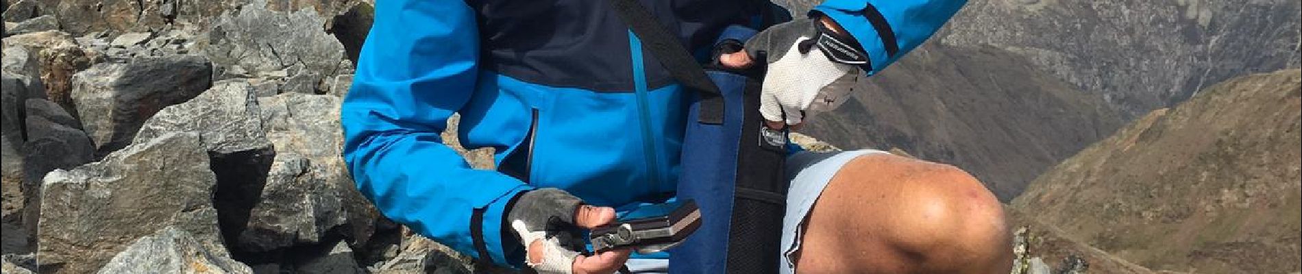
Trail Walking of 11.7 km to be discovered at Catalonia, Lleida, Alins. This trail is proposed by ARVIEU.
Photos

Positioning
Country:
Spain
Region :
Catalonia
Department/Province :
Lleida
Municipality :
Alins
Location:
Unknown
Start:(Dec)
Start:(UTM)
367835 ; 4720456 (31T) N.
Comments