


2022-09-14 Marche Suisse Triftbrucke

holtzv
User GUIDE


4h38
Difficulty : Medium

FREE GPS app for hiking
 SityTrail
IGN / Geographical institutes
SityTrail Plus
The world is yours!
About
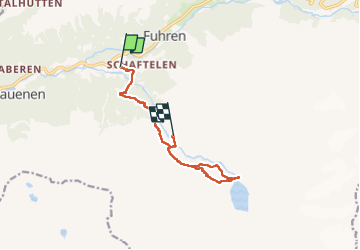
Trail Walking of 10.8 km to be discovered at Bern, Interlaken-Oberhasli administrative district, Innertkirchen. This trail is proposed by holtzv.
Description
Parking gratuit
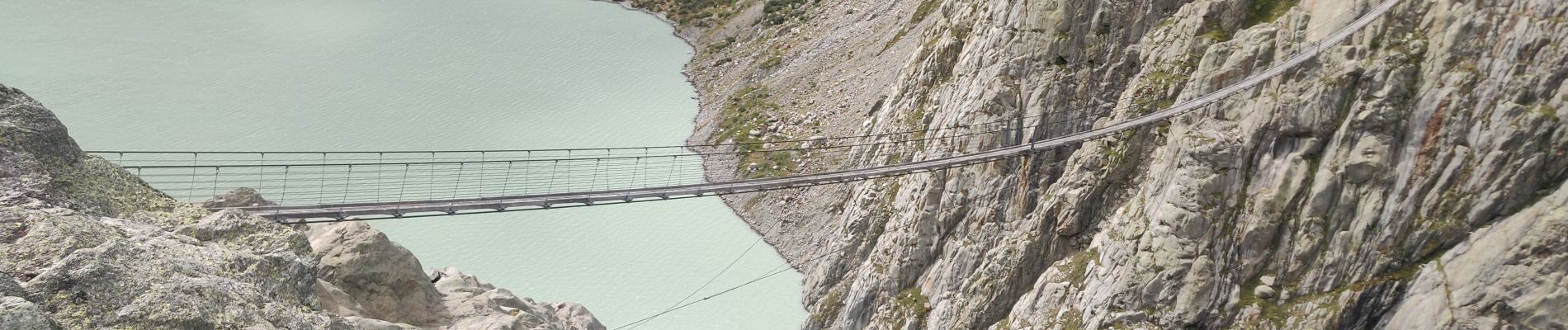
Le pont du Trift est l’un des ponts piétonniers suspendus les plus spectaculaires des Alpes.
Haut de 100 mètres et long de 170 mètres, il se balance au-dessus de la région du glacier du Trift, offrant des vues spectaculaires à ceux qui n’ont pas le vertige!
La vue est imprenable sur le lac glaciaire bleu turquoise et sur la langue du glacier du Trift.
Il a été construit en 2004 et remplacé en 2009 du fait de la fonte drastique du glacier.
Chemin de retour passant par la cabane Windegg pour prendre une petite soupe avant de prendre la télécabine du Trift (26 CHF) qui permet de revenir au parking.
Photos


Positioning
Comments