


Sixt Fer à Cheval

GOHIER
User
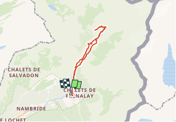

Length
12.3 km

Max alt
1405 m

Uphill gradient
522 m
Km-Effort
19.3 km

Min alt
949 m

Downhill gradient
512 m
Boucle
Yes
Creation date :
2022-09-11 08:52:45.0
Updated on :
2022-09-15 13:54:01.825
5h45
Difficulty : Very easy

FREE GPS app for hiking
 SityTrail
IGN / Geographical institutes
SityTrail Plus
The world is yours!
About
Trail Walking of 12.3 km to be discovered at Auvergne-Rhône-Alpes, Upper Savoy, Sixt-Fer-à-Cheval. This trail is proposed by GOHIER.
Description
Petit tour facile. Trop chaud
Positioning
Country:
France
Region :
Auvergne-Rhône-Alpes
Department/Province :
Upper Savoy
Municipality :
Sixt-Fer-à-Cheval
Location:
Unknown
Start:(Dec)
Start:(UTM)
332844 ; 5104932 (32T) N.
Comments