


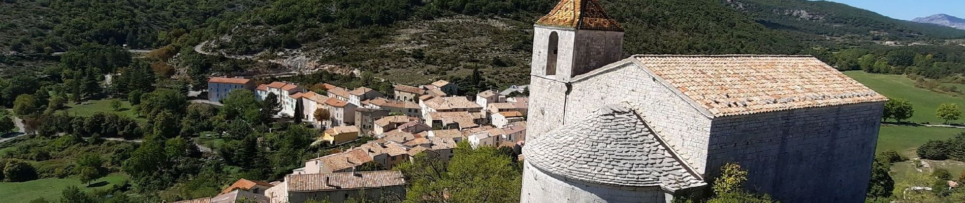
Comps-sur-Artuby Le Mauvais Pont et les Chapelles

Chantheys
User
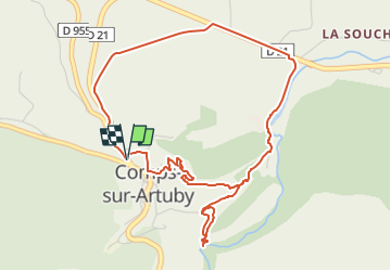

Length
5.7 km

Max alt
937 m

Uphill gradient
187 m
Km-Effort
8.2 km

Min alt
807 m

Downhill gradient
188 m
Boucle
Yes
Creation date :
2022-09-18 17:06:26.589
Updated on :
2022-09-18 18:41:26.128
1h52
Difficulty : Medium

FREE GPS app for hiking
 SityTrail
IGN / Geographical institutes
SityTrail Plus
The world is yours!
About
Trail Walking of 5.7 km to be discovered at Provence-Alpes-Côte d'Azur, Var, Comps-sur-Artuby. This trail is proposed by Chantheys.
Description
Oubliez les passages sur la D 955 et la D 21, concentrez-vous sur les paysages pour arriver sur le chemin du moulin. C'est là que la randonnée devient charmante.
Photos


Positioning
Country:
France
Region :
Provence-Alpes-Côte d'Azur
Department/Province :
Var
Municipality :
Comps-sur-Artuby
Location:
Unknown
Start:(Dec)
Start:(UTM)
299154 ; 4842744 (32T) N.
Comments