


beauvoisin

rando30129
User
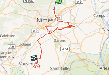

Length
94 km

Max alt
127 m

Uphill gradient
551 m
Km-Effort
102 km

Min alt
20 m

Downhill gradient
571 m
Boucle
No
Creation date :
2021-05-06 08:21:51.961
Updated on :
2022-09-20 08:04:47.348
13h46
Difficulty : Very difficult

FREE GPS app for hiking
 SityTrail
IGN / Geographical institutes
SityTrail Plus
The world is yours!
About
Trail Walking of 94 km to be discovered at Occitania, Gard, Nimes. This trail is proposed by rando30129.
Positioning
Country:
France
Region :
Occitania
Department/Province :
Gard
Municipality :
Nimes
Location:
Unknown
Start:(Dec)
Start:(UTM)
612785 ; 4859440 (31T) N.
Comments