


En remontant les Bozançons

psesjs
User

Length
18.3 km

Max alt
610 m

Uphill gradient
487 m
Km-Effort
25 km

Min alt
321 m

Downhill gradient
487 m
Boucle
Yes
Creation date :
2022-09-21 07:15:35.887
Updated on :
2022-09-21 14:07:38.967
4h44
Difficulty : Easy

FREE GPS app for hiking
 SityTrail
IGN / Geographical institutes
SityTrail Plus
The world is yours!
About
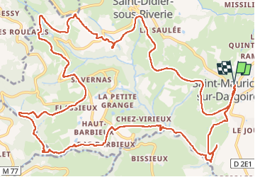
Trail Walking of 18.3 km to be discovered at Auvergne-Rhône-Alpes, Rhône, Chabanière. This trail is proposed by psesjs.
Positioning
Country:
France
Region :
Auvergne-Rhône-Alpes
Department/Province :
Rhône
Municipality :
Chabanière
Location:
Saint-Maurice-sur-Dargoire
Start:(Dec)
Start:(UTM)
627234 ; 5048976 (31T) N.
Comments