Trail Walking Clervaux - 2022-09-22_13h18m05_t62883822_eislek pad heinerscheid - Photo

2022-09-22_13h18m05_t62883822_eislek pad heinerscheid

© OpenStreetMap contributors
Length
Length
15.8 km
Max alt
Max alt
532 m
Uphill gradient
Uphill gradient
475 m
Km-Effort
Km-Effort  
22 km
Min alt
Min alt
292 m
Downhill gradient
Downhill gradient
475 m
Boucle
Boucle
Yes
Creation date :
2022-09-22 11:18:05.268
Updated on :
2022-09-22 11:21:09.584

(1 Reviews)

Walking
Walking
5h02
Difficulty : Medium

Scan this QR Code to open this trail in the SityTrail application

FREE GPS app for hiking

Logo SityTrail SityTrail

IGN / Geographical institutes

Download SityTrail from the App Store Download SityTrail from Google Play

Logo SityTrail SityTrail World

The world is yours!

Download SityTrail from the App Store Download SityTrail from Google Play Download SityTrail on Huawei AppGallery

About

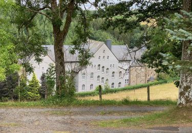
Trail Walking of 15.8 km to be discovered at Unknown, Canton Clervaux, Clervaux. This trail is proposed by mumu.larandonneuse.

Description

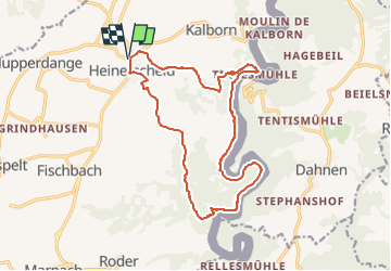
Éislek Pad Heinerscheid
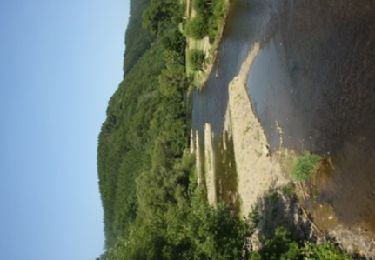
Vers la vallée profonde

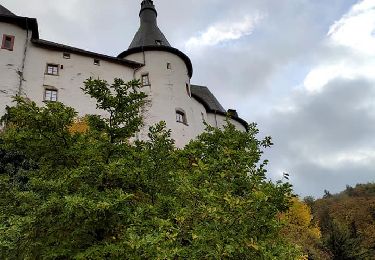
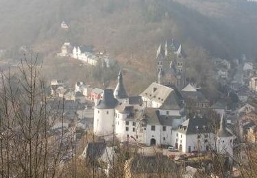
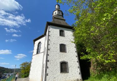
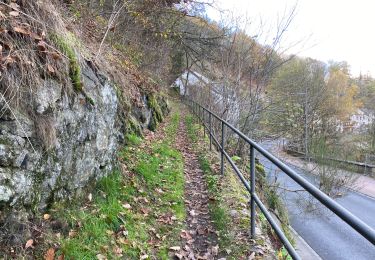
Votre chemin commence au sommet de Heinerscheid. Arrêtez-vous un instant devant le monument de la 6th Armored Division. Puis, pas à pas, vous descendez dans la vallée de l'Our. Avant de descendre complètement, vous traverserez une crête rocheuse abrupte, la Kasselslee. De là, vous pourrez apercevoir pour la première fois la rivière qui vous accompagnera tout le reste du chemin. La montée vers le point de vue Kailslee vous fait sortir de la vallée.

Départ : Parking à la sortie du village, Hepperdangerstrooss, Heinerscheid

Arrivée : Parking à la sortie du village, Hepperdangerstrooss, Heinerscheid

Distance : 15,843 km

Altitude : 528 m

Temps : 04h50

ℹ sur www.visit-eislek.lu

Elevation profile

Positioning

Country:
Luxembourg
Region :
Unknown
Department/Province :
Canton Clervaux
Municipality :
Clervaux
Location:
Unknown
Start:(UTM)
291606 ; 5553439 (32U) N.

Comments

Please log in to post a review or rate the element


Trails nearby

Trail Walking Clervaux - 2023-09-06_11h37m03_sentier-local-cl-5 - Photo
Walking
GUIDE
mumu.larandonneuse

Walking

Difficult
(1)
Clervaux, Unknown, Canton Clervaux, Luxembourg
12.5 km | 18.6 km-effort
4h 13min
Yes
Trail Walking Clervaux - 2023-09-06_11h14m49_sentier-local-cl-2 - Photo
Walking
GUIDE
mumu.larandonneuse

Walking

Medium
(1)
Clervaux, Unknown, Canton Clervaux, Luxembourg
7.1 km | 9.9 km-effort
2h 14min
Yes
Trail Walking Burg-Reuland - Ouren - Natura 2000, des sites qui valent le détour, Lg16 - Photo
Walking
GUIDE+

Walking

Difficult
(1)
Burg-Reuland, Wallonia, Liège, Belgium
9 km | 12.1 km-effort
2h 36min
Yes
Trail Walking Clervaux - Eislek Pad Clervaux - Photo
Walking
GUIDE+

Walking

Difficult
Clervaux, Unknown, Canton Clervaux, Luxembourg
13.2 km | 18.5 km-effort
4h 11min
Yes
Trail On foot Burg-Reuland - Ouren - Balade 28 - Guide de l'Ardenne du Nord - Photo
On foot
AnneCecile

On foot

Very easy
(1)
Burg-Reuland, Wallonia, Liège, Belgium
9 km | 12.1 km-effort
Unknown
Yes
Trail Walking Clervaux - Boucle Les paysages cachés - Tronçon 4 - Clervaux - Kautenbach - Photo
Walking
GUIDE+

Walking

Very easy
Clervaux, Unknown, Canton Clervaux, Luxembourg
26 km | 38 km-effort
Unknown
No
Trail Walking Clervaux - LW_CL_2 - Photo
Walking
jipysn

Walking

Medium
Clervaux, Unknown, Canton Clervaux, Luxembourg
6.6 km | 9.2 km-effort
2h 5min
Yes
Trail Walking Clervaux - Clervaux Abbaye et Mecher 10 km boucle - Photo
Walking
GUIDE
rvapeldo

Walking

Easy
Clervaux, Unknown, Canton Clervaux, Luxembourg
10 km | 13.8 km-effort
3h 29min
Yes
Trail Walking Clervaux - Escapardenne Eisleck Trail: Clervaux - Moulin d'Asselborn - Photo
Walking
dauzata

Walking

Medium
Clervaux, Unknown, Canton Clervaux, Luxembourg
21 km | 30 km-effort
5h 43min
No


Close
My subscriptions