


le croupatier

bernir
User
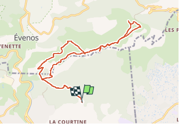

Length
12.4 km

Max alt
506 m

Uphill gradient
385 m
Km-Effort
17.6 km

Min alt
176 m

Downhill gradient
387 m
Boucle
Yes
Creation date :
2022-09-22 06:59:07.125
Updated on :
2022-09-26 09:56:31.192
4h02
Difficulty : Easy

FREE GPS app for hiking
 SityTrail
IGN / Geographical institutes
SityTrail Plus
The world is yours!
About
Trail Walking of 12.4 km to be discovered at Provence-Alpes-Côte d'Azur, Var, Ollioules. This trail is proposed by bernir.
Positioning
Country:
France
Region :
Provence-Alpes-Côte d'Azur
Department/Province :
Var
Municipality :
Ollioules
Location:
Unknown
Start:(Dec)
Start:(UTM)
733065 ; 4781113 (31T) N.
Comments