


remoray

dcharbonnier
User
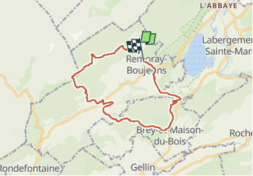

Length
14.3 km

Max alt
1066 m

Uphill gradient
371 m
Km-Effort
19.4 km

Min alt
855 m

Downhill gradient
420 m
Boucle
No
Creation date :
2022-09-22 07:51:01.729
Updated on :
2022-09-22 13:26:47.828
5h34
Difficulty : Very difficult

FREE GPS app for hiking
 SityTrail
IGN / Geographical institutes
SityTrail Plus
The world is yours!
About
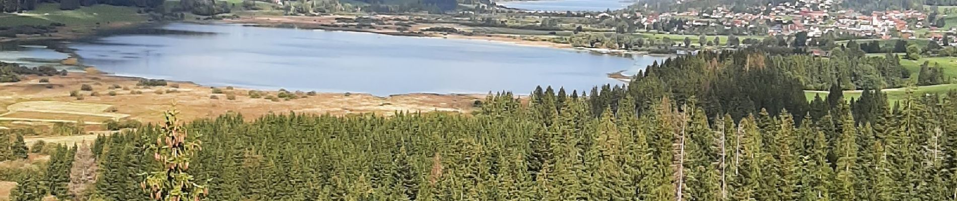
Trail Walking of 14.3 km to be discovered at Bourgogne-Franche-Comté, Doubs, Remoray-Boujeons. This trail is proposed by dcharbonnier.
Photos

Positioning
Country:
France
Region :
Bourgogne-Franche-Comté
Department/Province :
Doubs
Municipality :
Remoray-Boujeons
Location:
Unknown
Start:(Dec)
Start:(UTM)
289003 ; 5183497 (32T) N.
Comments