Trail Walking Moustiers-Sainte-Marie - Col de l'Ane col de Plein voir - Photo
 aljac
aljac

User

© OpenStreetMap contributors
Length
Length
9 km
Max alt
Max alt
1184 m
Uphill gradient
Uphill gradient
624 m
Km-Effort
Km-Effort  
17.3 km
Min alt
Min alt
653 m
Downhill gradient
Downhill gradient
624 m
Boucle
Boucle
Yes
Creation date :
2022-09-23 18:51:07.735
Updated on :
2022-09-23 19:04:22.835

(0 Reviews)

Walking
Walking
3h55
Difficulty : Difficult

Scan this QR Code to open this trail in the SityTrail application

FREE GPS app for hiking

Logo SityTrail SityTrail

IGN / Geographical institutes

Download SityTrail from the App Store Download SityTrail from Google Play

Logo SityTrail SityTrail Plus

The world is yours!

Download SityTrail from the App Store Download SityTrail from Google Play Download SityTrail on Huawei AppGallery

About

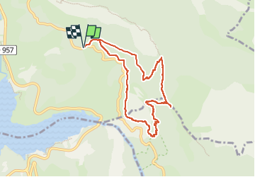
Trail Walking of 9 km to be discovered at Provence-Alpes-Côte d'Azur, Alpes-de-Haute-Provence, Moustiers-Sainte-Marie. This trail is proposed by aljac.

Description

Belle randonnée avec vue quasi permanente sur le lac, le Verdon et les vautours fauves. Les résurgences des grottes de St Maurin sont à sec.
NB : le sentier des pêcheurs, qui pourrait faire jonction  est INTERDIT  ( même à partir du col de l'Olivier).

Elevation profile

Positioning

Country:
France
Region :
Provence-Alpes-Côte d'Azur
Department/Province :
Alpes-de-Haute-Provence
Municipality :
Moustiers-Sainte-Marie
Location:
Unknown
Start:(UTM)
278487 ; 4854997 (32T) N.


Close
My subscriptions