


24.09.22 Saulzet le froid

ffffff
User

Length
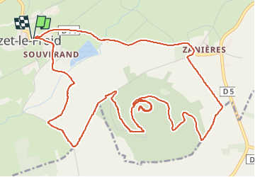
7.9 km

Max alt
1170 m

Uphill gradient
207 m
Km-Effort
10.7 km

Min alt
997 m

Downhill gradient
207 m
Boucle
Yes
Creation date :
2022-09-24 13:35:59.776
Updated on :
2022-09-24 16:28:19.08
1h58
Difficulty : Medium

FREE GPS app for hiking
 SityTrail
IGN / Geographical institutes
SityTrail Plus
The world is yours!
About
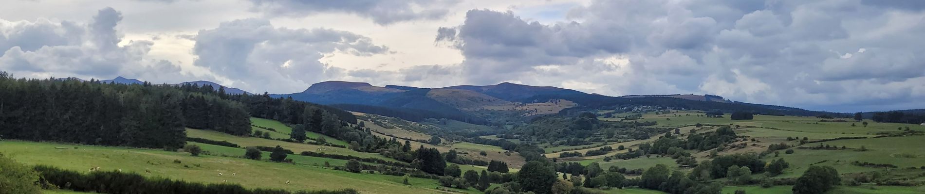
Trail Walking of 7.9 km to be discovered at Auvergne-Rhône-Alpes, Puy-de-Dôme, Saulzet-le-Froid. This trail is proposed by ffffff.
Photos


Positioning
Country:
France
Region :
Auvergne-Rhône-Alpes
Department/Province :
Puy-de-Dôme
Municipality :
Saulzet-le-Froid
Location:
Unknown
Start:(Dec)
Start:(UTM)
493753 ; 5054233 (31T) N.
Comments