


Blois la paix

potons
User
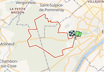

Length
16.7 km

Max alt
164 m

Uphill gradient
159 m
Km-Effort
18.9 km

Min alt
105 m

Downhill gradient
177 m
Boucle
Yes
Creation date :
2022-09-25 06:20:48.0
Updated on :
2022-09-25 09:31:26.204
2h59
Difficulty : Easy

FREE GPS app for hiking
 SityTrail
IGN / Geographical institutes
SityTrail Plus
The world is yours!
About
Trail Walking of 16.7 km to be discovered at Centre-Loire Valley, Loir-et-Cher, Blois. This trail is proposed by potons.
Description
Forêt
Positioning
Country:
France
Region :
Centre-Loire Valley
Department/Province :
Loir-et-Cher
Municipality :
Blois
Location:
Unknown
Start:(Dec)
Start:(UTM)
371810 ; 5271080 (31T) N.
Comments