


Luminy- mont carpiagne

mapomme
User
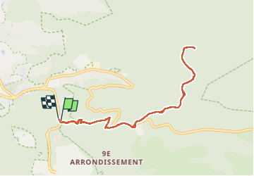

Length
9.9 km

Max alt
639 m

Uphill gradient
546 m
Km-Effort
17.2 km

Min alt
109 m

Downhill gradient
543 m
Boucle
Yes
Creation date :
2022-09-25 07:51:42.0
Updated on :
2022-09-25 13:23:07.761
4h09
Difficulty : Medium

FREE GPS app for hiking
 SityTrail
IGN / Geographical institutes
SityTrail Plus
The world is yours!
About
Trail Walking of 9.9 km to be discovered at Provence-Alpes-Côte d'Azur, Bouches-du-Rhône, Marseille. This trail is proposed by mapomme.
Positioning
Country:
France
Region :
Provence-Alpes-Côte d'Azur
Department/Province :
Bouches-du-Rhône
Municipality :
Marseille
Location:
9th Arrondissement
Start:(Dec)
Start:(UTM)
698017 ; 4790427 (31T) N.
Comments