


rando

loca.yves
User GUIDE

Length
12.1 km

Max alt
1032 m

Uphill gradient
693 m
Km-Effort
21 km

Min alt
484 m

Downhill gradient
580 m
Boucle
No
Creation date :
2022-09-26 07:27:07.335
Updated on :
2022-09-26 15:40:14.991
6h09
Difficulty : Very difficult

FREE GPS app for hiking
 SityTrail
IGN / Geographical institutes
SityTrail Plus
The world is yours!
About
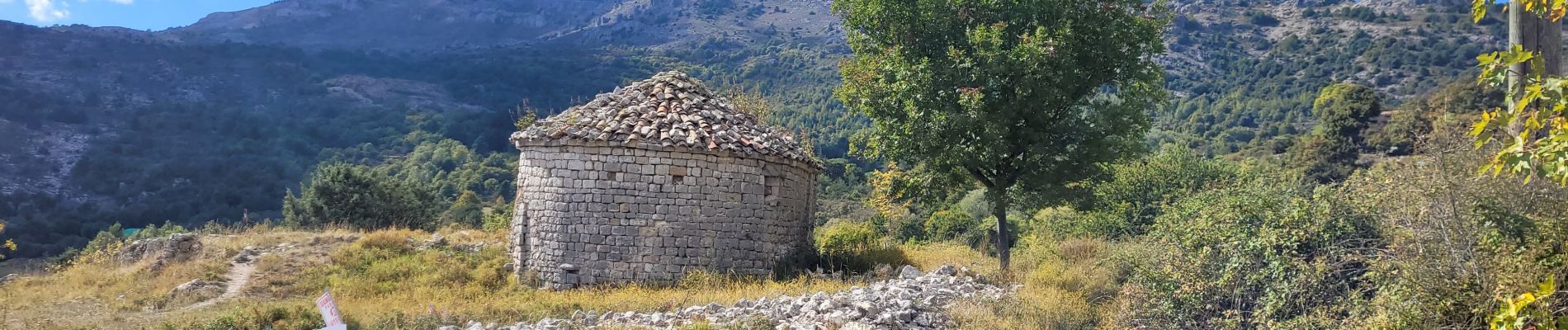
Trail Walking of 12.1 km to be discovered at Provence-Alpes-Côte d'Azur, Maritime Alps, Le Bar-sur-Loup. This trail is proposed by loca.yves.
Description
dure
Photos


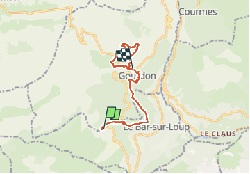
Positioning
Country:
France
Region :
Provence-Alpes-Côte d'Azur
Department/Province :
Maritime Alps
Municipality :
Le Bar-sur-Loup
Location:
Unknown
Start:(Dec)
Start:(UTM)
335789 ; 4840619 (32T) N.
Comments