


thomery

lm178
User
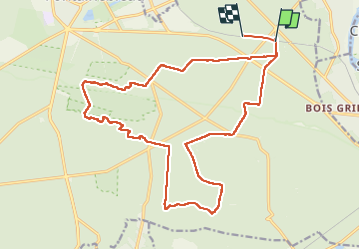

Length
22 km

Max alt
138 m

Uphill gradient
293 m
Km-Effort
26 km

Min alt
81 m

Downhill gradient
295 m
Boucle
No
Creation date :
2022-09-19 08:02:17.907
Updated on :
2022-09-26 16:56:20.661
5h29
Difficulty : Very easy

FREE GPS app for hiking
 SityTrail
IGN / Geographical institutes
SityTrail Plus
The world is yours!
About
Trail Walking of 22 km to be discovered at Ile-de-France, Seine-et-Marne, Fontainebleau. This trail is proposed by lm178.
Positioning
Country:
France
Region :
Ile-de-France
Department/Province :
Seine-et-Marne
Municipality :
Fontainebleau
Location:
Unknown
Start:(Dec)
Start:(UTM)
482497 ; 5360168 (31U) N.
Comments