


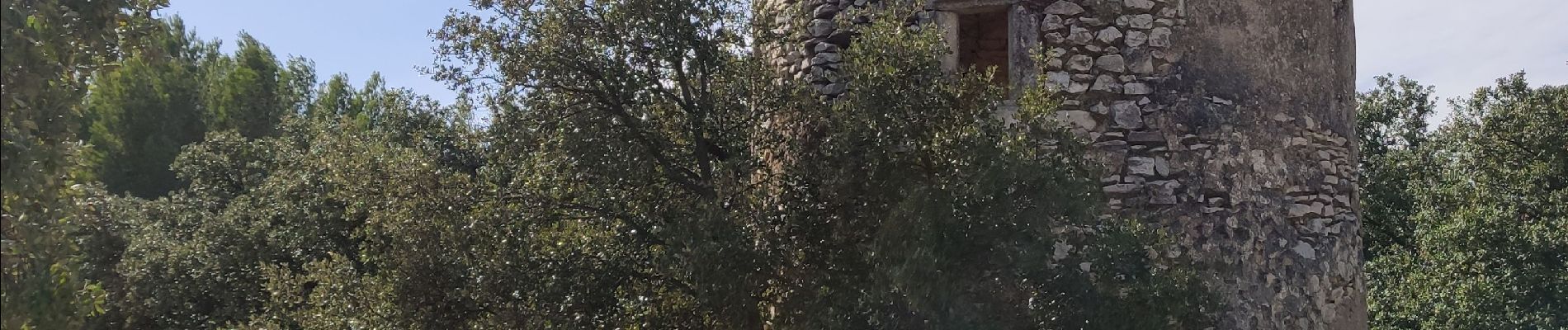
Marguerittes - Combe-des-bourguignons

rando30129
User
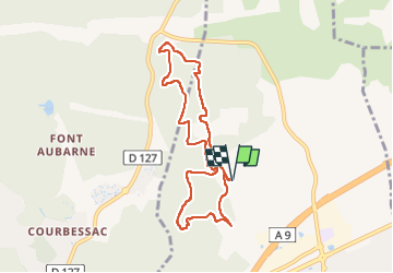

Length
8.4 km

Max alt
173 m

Uphill gradient
130 m
Km-Effort
10.1 km

Min alt
84 m

Downhill gradient
129 m
Boucle
Yes
Creation date :
2022-09-27 11:44:06.186
Updated on :
2022-09-27 16:57:48.973
2h22
Difficulty : Medium

FREE GPS app for hiking
 SityTrail
IGN / Geographical institutes
SityTrail Plus
The world is yours!
About
Trail Walking of 8.4 km to be discovered at Occitania, Gard, Marguerittes. This trail is proposed by rando30129.
Photos


Positioning
Country:
France
Region :
Occitania
Department/Province :
Gard
Municipality :
Marguerittes
Location:
Unknown
Start:(Dec)
Start:(UTM)
614905 ; 4858984 (31T) N.
Comments