


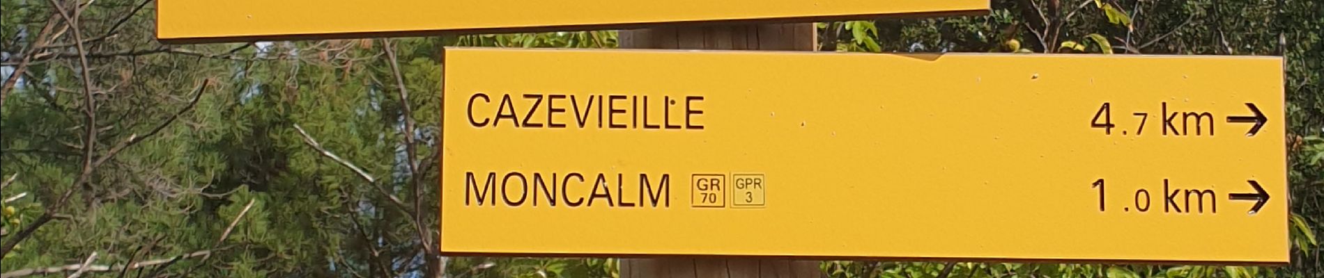
montcalm

JMJ42
User
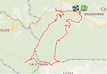

Length
12.8 km

Max alt
559 m

Uphill gradient
473 m
Km-Effort
19.1 km

Min alt
153 m

Downhill gradient
472 m
Boucle
Yes
Creation date :
2022-09-27 07:37:36.519
Updated on :
2022-09-29 06:24:36.019
3h40
Difficulty : Medium

FREE GPS app for hiking
 SityTrail
IGN / Geographical institutes
SityTrail Plus
The world is yours!
About
Trail Walking of 12.8 km to be discovered at Occitania, Gard, Cendras. This trail is proposed by JMJ42.
Photos

Positioning
Country:
France
Region :
Occitania
Department/Province :
Gard
Municipality :
Cendras
Location:
Unknown
Start:(Dec)
Start:(UTM)
583033 ; 4889518 (31T) N.
Comments