


Whitefish Lupfer

Clydesdale
User
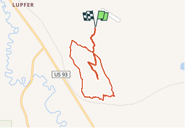

Length
8.1 km

Max alt
1051 m

Uphill gradient
206 m
Km-Effort
10.9 km

Min alt
962 m

Downhill gradient
206 m
Boucle
Yes
Creation date :
2022-10-01 17:51:10.607
Updated on :
2022-10-01 20:02:01.102
2h09
Difficulty : Easy

FREE GPS app for hiking
 SityTrail
IGN / Geographical institutes
SityTrail World
The world is yours!
About
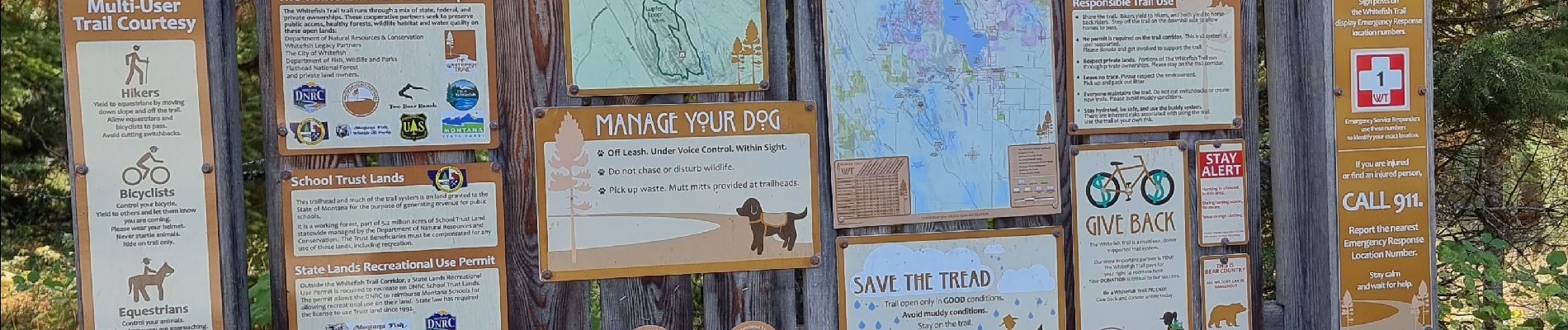
Trail Trail of 8.1 km to be discovered at Montana, Flathead County. This trail is proposed by Clydesdale.
Photos

Positioning
Country:
United States
Region :
Montana
Department/Province :
Flathead County
Municipality :
Unknown
Location:
Unknown
Start:(Dec)
Start:(UTM)
685727 ; 5372544 (11U) N.
Comments
Trails nearby