


Pierlas

Arnaud Stévenard
User

Length
13.7 km

Max alt
1618 m

Uphill gradient
600 m
Km-Effort
22 km

Min alt
1067 m

Downhill gradient
619 m
Boucle
Yes
Creation date :
2022-10-02 07:47:57.0
Updated on :
2022-10-02 15:49:38.4
6h28
Difficulty : Easy

FREE GPS app for hiking
 SityTrail
IGN / Geographical institutes
SityTrail Plus
The world is yours!
About
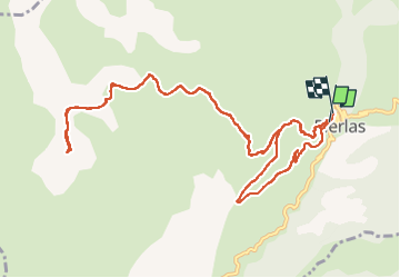
Trail Walking of 13.7 km to be discovered at Provence-Alpes-Côte d'Azur, Maritime Alps, Pierlas. This trail is proposed by Arnaud Stévenard.
Positioning
Country:
France
Region :
Provence-Alpes-Côte d'Azur
Department/Province :
Maritime Alps
Municipality :
Pierlas
Location:
Unknown
Start:(Dec)
Start:(UTM)
342451 ; 4877289 (32T) N.
Comments