


Vaufrey

Danielj
User

Length
12.7 km

Max alt
741 m

Uphill gradient
511 m
Km-Effort
19.5 km

Min alt
395 m

Downhill gradient
511 m
Boucle
Yes
Creation date :
2022-10-04 08:12:44.0
Updated on :
2022-10-04 14:25:07.292
5h19
Difficulty : Very difficult

FREE GPS app for hiking
 SityTrail
IGN / Geographical institutes
SityTrail Plus
The world is yours!
About
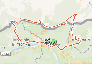
Trail Walking of 12.7 km to be discovered at Bourgogne-Franche-Comté, Doubs, Vaufrey. This trail is proposed by Danielj.
Positioning
Country:
France
Region :
Bourgogne-Franche-Comté
Department/Province :
Doubs
Municipality :
Vaufrey
Location:
Unknown
Start:(Dec)
Start:(UTM)
343044 ; 5245805 (32T) N.
Comments