


autour de olocau

nave
User

Length
14.2 km

Max alt
571 m

Uphill gradient
372 m
Km-Effort
19.6 km

Min alt
184 m

Downhill gradient
507 m
Boucle
No
Creation date :
2022-10-04 11:57:17.028
Updated on :
2022-10-04 15:32:49.464
3h34
Difficulty : Very difficult

FREE GPS app for hiking
 SityTrail
IGN / Geographical institutes
SityTrail Plus
The world is yours!
About
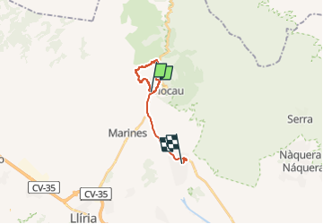
Trail Walking of 14.2 km to be discovered at Valencian Community, Valencia, Olocau. This trail is proposed by nave.
Description
Randonnée de 3:30 h avec une montée un peu raide sur 30 minutes. Pas de réelle difficultés. Les bâtons peuvent être utiles
Positioning
Country:
Spain
Region :
Valencian Community
Department/Province :
Valencia
Municipality :
Olocau
Location:
Unknown
Start:(Dec)
Start:(UTM)
710684 ; 4397289 (30S) N.
Comments