Trail Walking Barjac - LeChemin des Ecoliers - Photo

LeChemin des Ecoliers

© OpenStreetMap contributors
Length
Length
8.4 km
Max alt
Max alt
909 m
Uphill gradient
Uphill gradient
291 m
Km-Effort
Km-Effort  
12.2 km
Min alt
Min alt
658 m
Downhill gradient
Downhill gradient
292 m
Boucle
Boucle
Yes
Creation date :
2022-10-04 13:13:58.073
Updated on :
2022-10-04 16:06:51.596

(0 Reviews)

Walking
Walking
2h43
Difficulty : Medium

Scan this QR Code to open this trail in the SityTrail application

FREE GPS app for hiking

Logo SityTrail SityTrail

IGN / Geographical institutes

Download SityTrail from the App Store Download SityTrail from Google Play

Logo SityTrail SityTrail World

The world is yours!

Download SityTrail from the App Store Download SityTrail from Google Play Download SityTrail on Huawei AppGallery

About

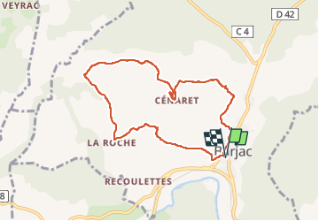
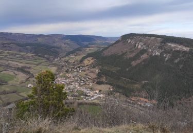
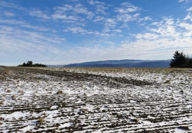
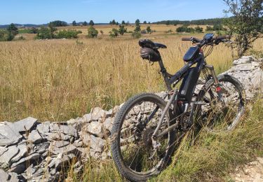
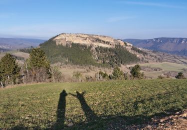
Trail Walking of 8.4 km to be discovered at Occitania, Lozère, Barjac. This trail is proposed by Lecoester.

Description

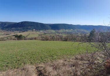
Très joli chemin avec de beaux points de vue. Le détour par la Vierge du Cenaret rallonge un peu la rando (500m AR) mais ça en vaut la peine. le retour tout en descente est agréable mais sûrement dangereux par temps de pluie.

Elevation profile

Photos

Positioning

Country:
France
Region :
Occitania
Department/Province :
Lozère
Municipality :
Barjac
Location:
Unknown
Start:(UTM)
532591 ; 4927825 (31T) N.

Trails nearby

Trail Motorbike Gabrias - retour  - Photo
Motorbike
Daniel Dufour

Motorbike

Very easy
(1)
Gabrias, Occitania, Lozère, France
4 km | 5.4 km-effort
1h 0min
No
Trail Running Gabrias - traking - Photo
Running
pignol

Running

Difficult
Gabrias, Occitania, Lozère, France
7.3 km | 12.5 km-effort
2h 1min
Yes
Trail Walking Esclanèdes - Rocherousse Marijoulet - Photo
Walking
tyntyn

Walking

Difficult
Esclanèdes, Occitania, Lozère, France
10.5 km | 16.4 km-effort
2h 58min
Yes
Trail Walking Barjac - Villaret - Photo
Walking
tyntyn

Walking

Difficult
Barjac, Occitania, Lozère, France
12.9 km | 18.4 km-effort
3h 24min
Yes
Trail Walking Mende - Mende - La Fage - Photo
Walking
nolsim

Walking

Difficult
Mende, Occitania, Lozère, France
28 km | 41 km-effort
8h 32min
No
Trail Other activity Gabrias - traking-tir parcours n*1 - Photo
Other activity
pignol

Other activity

Very easy
(1)
Gabrias, Occitania, Lozère, France
4.8 km | 8.3 km-effort
1h 55min
Yes
Trail Walking Mende - Bahours /Chauvet  - Photo
Walking
tyntyn

Walking

Medium
Mende, Occitania, Lozère, France
11.9 km | 16.6 km-effort
3h 18min
Yes
Trail Mountain bike Esclanèdes - esclanedes sauveterre le sec esclanedes  - Photo
Mountain bike
tyntyn

Mountain bike

Easy
Esclanèdes, Occitania, Lozère, France
42 km | 53 km-effort
3h 11min
Yes
Trail Walking Barjac - la roche /Veyrac/Vielbougue  - Photo
Walking
tyntyn

Walking

Medium
Barjac, Occitania, Lozère, France
11.5 km | 17 km-effort
3h 17min
Yes


Close
My subscriptions