


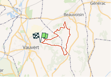
Rando cistée Vauvert

masseronmichel
User

Length
11.4 km

Max alt
110 m

Uphill gradient
172 m
Km-Effort
13.7 km

Min alt
38 m

Downhill gradient
172 m
Boucle
Yes
Creation date :
2022-10-08 15:06:33.955
Updated on :
2024-06-29 10:51:14.76
0m
Difficulty : Very easy

FREE GPS app for hiking
 SityTrail
IGN / Geographical institutes
SityTrail Plus
The world is yours!
About
Trail Geocaching of 11.4 km to be discovered at Occitania, Gard, Vauvert. This trail is proposed by masseronmichel.
Positioning
Country:
France
Region :
Occitania
Department/Province :
Gard
Municipality :
Vauvert
Location:
Unknown
Start:(Dec)
Start:(UTM)
603660 ; 4838939 (31T) N.
Comments