Trail Walking Roubion - 
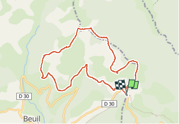
Col Couillole Ars Buissieres - Photo
 GrouGary
GrouGary

User

© OpenStreetMap contributors
Length
Length
10.5 km
Max alt
Max alt
1949 m
Uphill gradient
Uphill gradient
509 m
Km-Effort
Km-Effort  
17.3 km
Min alt
Min alt
1585 m
Downhill gradient
Downhill gradient
508 m
Boucle
Boucle
Yes
Creation date :
2022-10-08 07:31:46.289
Updated on :
2022-10-08 17:26:47.572

(0 Reviews)

Walking
Walking
3h30
Difficulty : Easy

Scan this QR Code to open this trail in the SityTrail application

FREE GPS app for hiking

Logo SityTrail SityTrail

IGN / Geographical institutes

Download SityTrail from the App Store Download SityTrail from Google Play

Logo SityTrail SityTrail Plus

The world is yours!

Download SityTrail from the App Store Download SityTrail from Google Play Download SityTrail on Huawei AppGallery

About

Trail Walking of 10.5 km to be discovered at Provence-Alpes-Côte d'Azur, Maritime Alps, Roubion. This trail is proposed by GrouGary.

Description

Boucle dans les 2 sens, sans difficulté technique, pour randonnée pédestre ou raquettes.
R : en Raquettes, préférer monter sur le sommet du Countent au lieu de traverser sous le sommet du Countent car léger dévers sur zone un peu exposée.
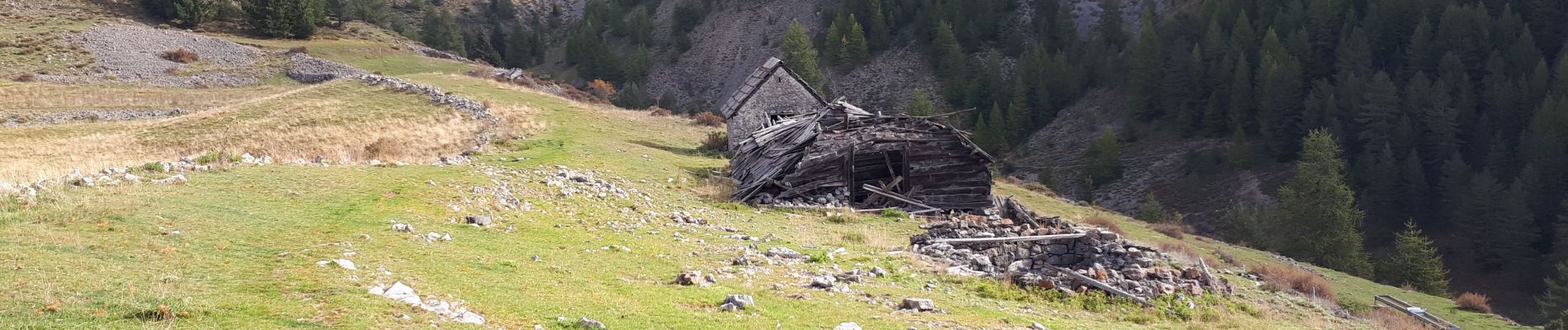
Elevation profile

Photos

Positioning

Country:
France
Region :
Provence-Alpes-Côte d'Azur
Department/Province :
Maritime Alps
Municipality :
Roubion
Location:
Unknown
Start:(UTM)
341759 ; 4884910 (32T) N.


Close
My subscriptions