


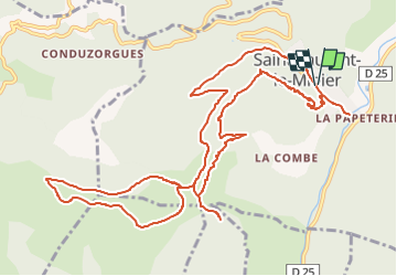
St Laurent le Minier, Anjeau

34christophe
User

Length
14.8 km

Max alt
750 m

Uphill gradient
696 m
Km-Effort
24 km

Min alt
167 m

Downhill gradient
694 m
Boucle
Yes
Creation date :
2022-10-08 20:21:15.953
Updated on :
2022-10-08 20:25:20.213
5h28
Difficulty : Very difficult

FREE GPS app for hiking
 SityTrail
IGN / Geographical institutes
SityTrail Plus
The world is yours!
About
Trail Walking of 14.8 km to be discovered at Occitania, Gard, Saint-Laurent-le-Minier. This trail is proposed by 34christophe.
Description
St Laurent le Minier village, tour du pic d'Anjeau, grotte d'Anjeau, cascade
Positioning
Country:
France
Region :
Occitania
Department/Province :
Gard
Municipality :
Saint-Laurent-le-Minier
Location:
Unknown
Start:(Dec)
Start:(UTM)
552797 ; 4864221 (31T) N.
Comments