


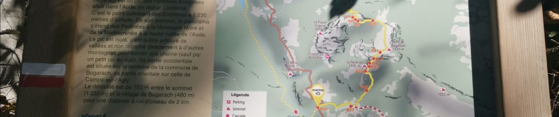
Tour Bugarach

Ada11
User GUIDE
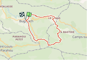

Length
16.1 km

Max alt
913 m

Uphill gradient
676 m
Km-Effort
25 km

Min alt
459 m

Downhill gradient
677 m
Boucle
Yes
Creation date :
2022-10-09 07:50:07.788
Updated on :
2022-10-09 14:16:03.187
4h11
Difficulty : Medium

FREE GPS app for hiking
 SityTrail
IGN / Geographical institutes
SityTrail Plus
The world is yours!
About
Trail Walking of 16.1 km to be discovered at Occitania, Aude, Bugarach. This trail is proposed by Ada11.
Photos


Positioning
Country:
France
Region :
Occitania
Department/Province :
Aude
Municipality :
Bugarach
Location:
Unknown
Start:(Dec)
Start:(UTM)
446905 ; 4747346 (31T) N.
Comments