


Belgentier - Dolomies et Ragage

soca
User
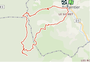

Length
12.1 km

Max alt
623 m

Uphill gradient
544 m
Km-Effort
19.3 km

Min alt
153 m

Downhill gradient
550 m
Boucle
Yes
Creation date :
2022-10-11 16:36:49.713
Updated on :
2022-10-11 16:54:33.751
3h00
Difficulty : Medium

FREE GPS app for hiking
 SityTrail
IGN / Geographical institutes
SityTrail Plus
The world is yours!
About
Trail Walking of 12.1 km to be discovered at Provence-Alpes-Côte d'Azur, Var, Belgentier. This trail is proposed by soca.
Positioning
Country:
France
Region :
Provence-Alpes-Côte d'Azur
Department/Province :
Var
Municipality :
Belgentier
Location:
Unknown
Start:(Dec)
Start:(UTM)
743398 ; 4792382 (31T) N.
Comments