


chanac sabatier villard

tyntyn
User
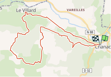

Length
13.4 km

Max alt
933 m

Uphill gradient
469 m
Km-Effort
19.6 km

Min alt
661 m

Downhill gradient
468 m
Boucle
Yes
Creation date :
2022-10-16 09:49:04.333
Updated on :
2022-10-16 09:51:41.765
4h27
Difficulty : Very difficult

FREE GPS app for hiking
 SityTrail
IGN / Geographical institutes
SityTrail Plus
The world is yours!
About
Trail Walking of 13.4 km to be discovered at Occitania, Lozère, Chanac. This trail is proposed by tyntyn.
Positioning
Country:
France
Region :
Occitania
Department/Province :
Lozère
Municipality :
Chanac
Location:
Chanac
Start:(Dec)
Start:(UTM)
527119 ; 4923758 (31T) N.
Comments