


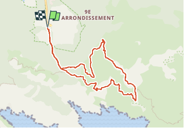
Boucle - aiguille Guillemain - Mont Puget - col de la Candelle

fhascoet
User

Length
10.9 km

Max alt
554 m

Uphill gradient
473 m
Km-Effort
17.2 km

Min alt
138 m

Downhill gradient
474 m
Boucle
Yes
Creation date :
2022-10-16 09:35:24.764
Updated on :
2022-10-16 20:06:26.714
3h05
Difficulty : Medium

FREE GPS app for hiking
 SityTrail
IGN / Geographical institutes
SityTrail Plus
The world is yours!
About
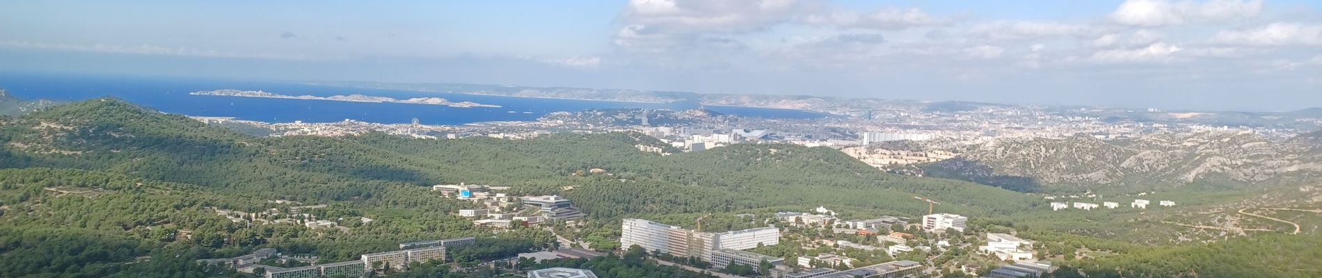
Trail Walking of 10.9 km to be discovered at Provence-Alpes-Côte d'Azur, Bouches-du-Rhône, Marseille. This trail is proposed by fhascoet.
Description
5 h de randonnée au total avec les arrets
Photos


Positioning
Country:
France
Region :
Provence-Alpes-Côte d'Azur
Department/Province :
Bouches-du-Rhône
Municipality :
Marseille
Location:
9th Arrondissement
Start:(Dec)
Start:(UTM)
697849 ; 4789343 (31T) N.
Comments